

Open User Map
Open User Map lets you create an interactive WordPress map where visitors can add locations, with approval workflows and no coding required.
AI tool Details
Explore More
Alternatives
About Open User Map
Open User Map is a powerful interactive map plugin for WordPress that transforms any website into a community-driven mapping platform. It allows website owners to create maps where visitors can contribute locations, add details, and engage with mapped content without any coding knowledge or complex setup. The plugin eliminates the need for a Google Maps API key and works seamlessly with WordPress integration. Open User Map is designed for businesses, organizations, and individuals who want to build collaborative maps for directories, event guides, tourism sites, community projects, real estate listings, or any use case requiring user-generated geographic data. The core value proposition is simplicity: no coding required, no API keys to manage, and no complex configuration. With over 15,000 active installs and a 100% five-star rating, it is the number two map plugin on WordPress.org. Open User Map offers both a free version and a PRO version with advanced features. The PRO version includes capabilities like custom images as maps, advanced filter interfaces, upvotes and likes, star ratings, opening hours display, and regions management. Every submission from visitors goes through an approval workflow, ensuring content quality and moderation control. The plugin supports powerful customization through custom fields, marker categories, lines and areas, and flexible filtering options. Whether you need a simple location directory or a complex interactive map with multiple data layers, Open User Map provides a complete solution that is accessible to non-technical users while offering depth for advanced projects.
Features
Frontend Location Submissions and Editing
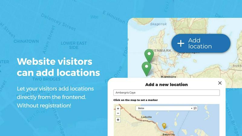
Enable your website visitors to add and edit locations directly on your map without accessing the WordPress admin panel. Clicking the Add location button lets users place a marker, fill out details, and submit for approval. The editing capability allows users to update their existing locations, ensuring the map always reflects the most current information. All submissions go through an approval workflow so you maintain full control over what appears publicly.
Marker Categories and Filtering
Organize your map effectively by grouping locations into marker categories, each distinguished by unique icons and colors. This setup clarifies the map layout and allows visitors to filter through different location types instantly. Each location can belong to multiple categories, ensuring all relevant attributes are represented. The filtering interface gives users a clear way to explore specific types of locations without clutter.
Lines and Areas
Go beyond simple location markers by adding routes, paths, zones, and regions directly to your map. This feature lets you highlight trails, service areas, event grounds, neighborhoods, construction zones, or any custom shape that helps visitors understand your map at a glance. Distances and area sizes are calculated automatically, so routes and polygons include helpful measurements right out of the box.
Custom Image as Map
Upload any image and transform it into a fully interactive map whether it is an overlay, floor plan, event layout, game map, product diagram, campus guide, or seating chart. Users can place markers directly on top of the image with the same powerful functionality as a traditional map. Add locations, display custom fields, enable filtering, and create an engaging clickable experience tailored exactly to your use case.
Use Cases
Community Location Directory
Build a community-driven directory where residents and visitors can add and update local businesses, points of interest, parks, and services. Users submit locations with details like hours, contact information, and categories. The approval workflow ensures accuracy and quality. Visitors can filter by category, rate locations with stars, and upvote favorites. This creates an ever-evolving resource that stays current without manual data entry.
Event and Festival Mapping
Create interactive maps for events, festivals, and conferences showing vendor locations, stages, restrooms, parking areas, and attractions. Attendees can add temporary locations like food trucks or pop-up activities. Use lines and areas to mark event boundaries, walkways, and designated zones. The custom image feature allows you to overlay markers on an event floor plan or site diagram for precise navigation.
Real Estate and Property Listings
Display available properties on an interactive map where agents can add listings with custom fields for price, bedrooms, square footage, and property type. Potential buyers can filter by criteria and click markers for detailed information. The star rating and upvote features let clients highlight favorite properties. Regions help define neighborhoods or districts, making property searches intuitive and visual.
Tourism and Travel Guides
Build comprehensive travel guides with user-contributed recommendations for restaurants, attractions, hotels, and hidden gems. Visitors can add their favorite spots with photos and descriptions. Use opening hours custom fields to show live Open Now indicators. Categories help separate dining, lodging, and activities. The upvote system surfaces the best locations automatically, creating a trusted community resource.
Frequently Asked Questions
Do I need a Google Maps API key to use Open User Map?
No, you do not need a Google Maps API key. Open User Map works without any external API keys or complex setup. The plugin handles all mapping functionality internally, making it simple to install and use directly from your WordPress dashboard.
Can visitors add locations without logging in?
Yes, visitors can add locations from the frontend of your website without needing a WordPress account. You have full control over whether submissions require user registration or can be submitted anonymously. All submissions go through an approval workflow before appearing publicly.
What is included in the PRO version?
The PRO version includes advanced features such as custom image as map, advanced filter interface, upvotes and likes, star rating system, opening hours with live Open Now indicator, regions management, and priority support. You can try all PRO features free for 7 days with no credit card required.
How does the approval workflow work?
When a visitor submits a location, it goes into a pending approval queue in your WordPress admin panel. You can review each submission, edit details if needed, and approve or reject it. Approved locations appear on the map immediately. This ensures all content meets your quality standards before going public.
Similar to Open User Map

Shopeasy.ai
Shopeasy.ai is an AI-native Commerce OS unifying storefront, payments, logistics, and POS into one platform for modern merchants.

Built2WinWeb
MCP, A2A, and llms.txt generation. Custom PHP websites built for AI agent discovery and indexing — flat‑fee, full ownership, no monthly fees.

IntelDif
IntelDif monitors competitors' public pages and alerts you only to strategic moves with AI-driven insight.
Unifyca
Unifyca centralizes documentation, credentials, maintenance, and backups for all your agency's WordPress sites.
blauwdruk.
Blauwdruk builds your entire website from design to SEO, so you can focus on your business with zero hassle.
Huebert
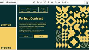
Huebert helps web creatives build stunning color palettes and UI themes in seconds with professional tools and AI assistance.

Shadcn Examples
Shadcn Examples offers reusable React and Tailwind UI kits with extensive components for building web apps effortlessly.

LaunchChair
LaunchChair turns vague ideas into validated MVP specs and build prompts so founders ship faster with less guessing.